FL-UAS 4 a joint drone team composed of personnel from the Hernando County Fire and Emergency Services (HCFES) and the Hernando Sheriff’s Office (HCSO) helped authorities in DeSoto County search for victims, assess road, bridge and flooding damage and create disaster area maps in the days following Hurricane Ian. Known as FL-UAS 4, the deployment was the joint regional drone team’s first assignment since it was established and recognized by the Florida Division of Emergency Management (FDEM) in May.
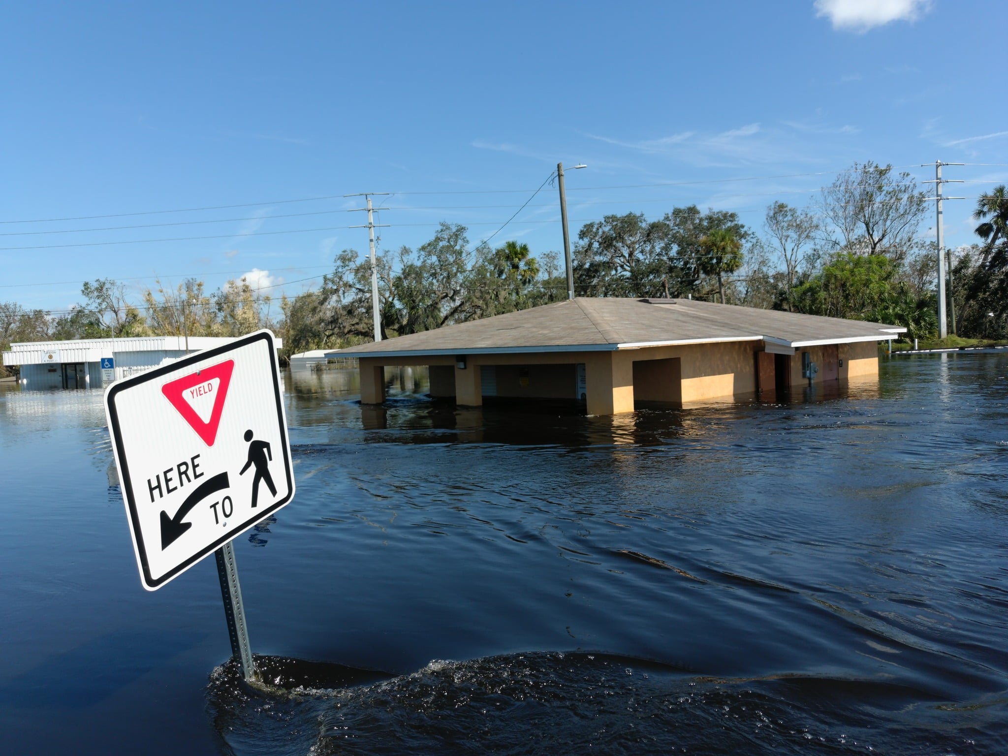
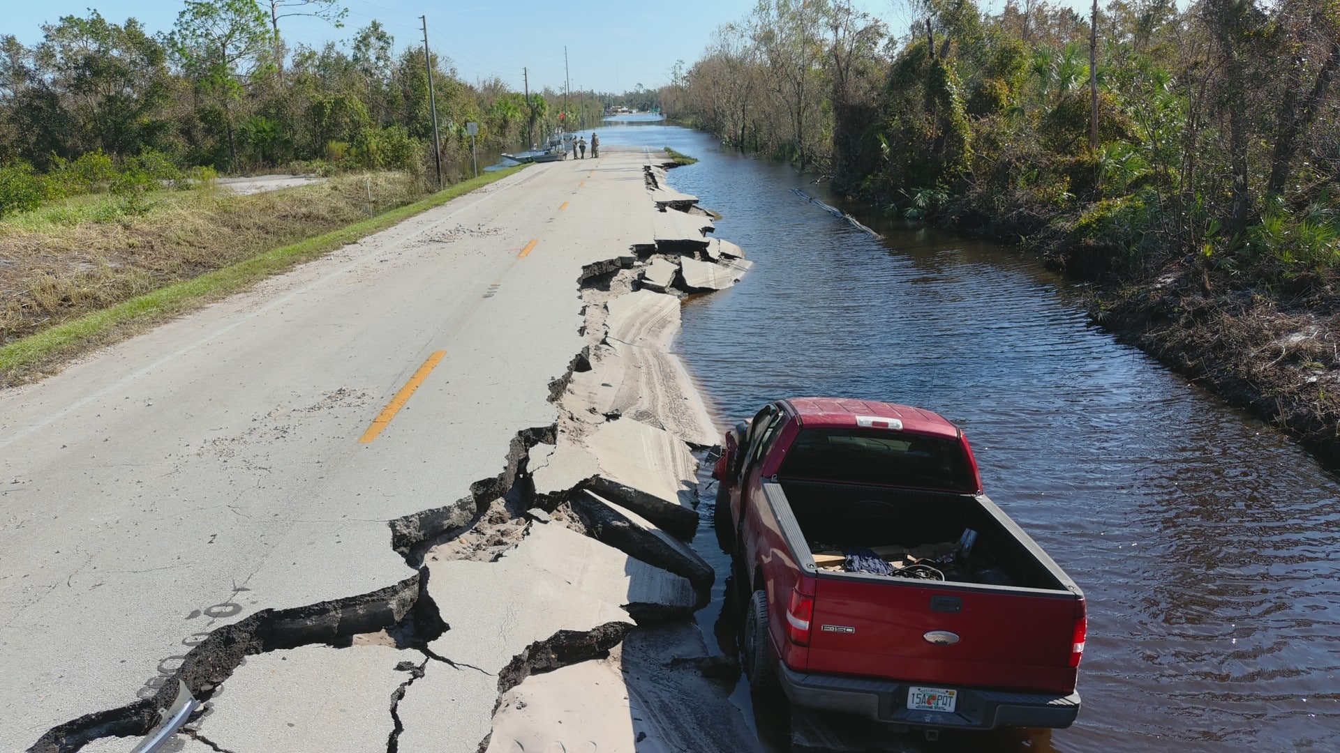
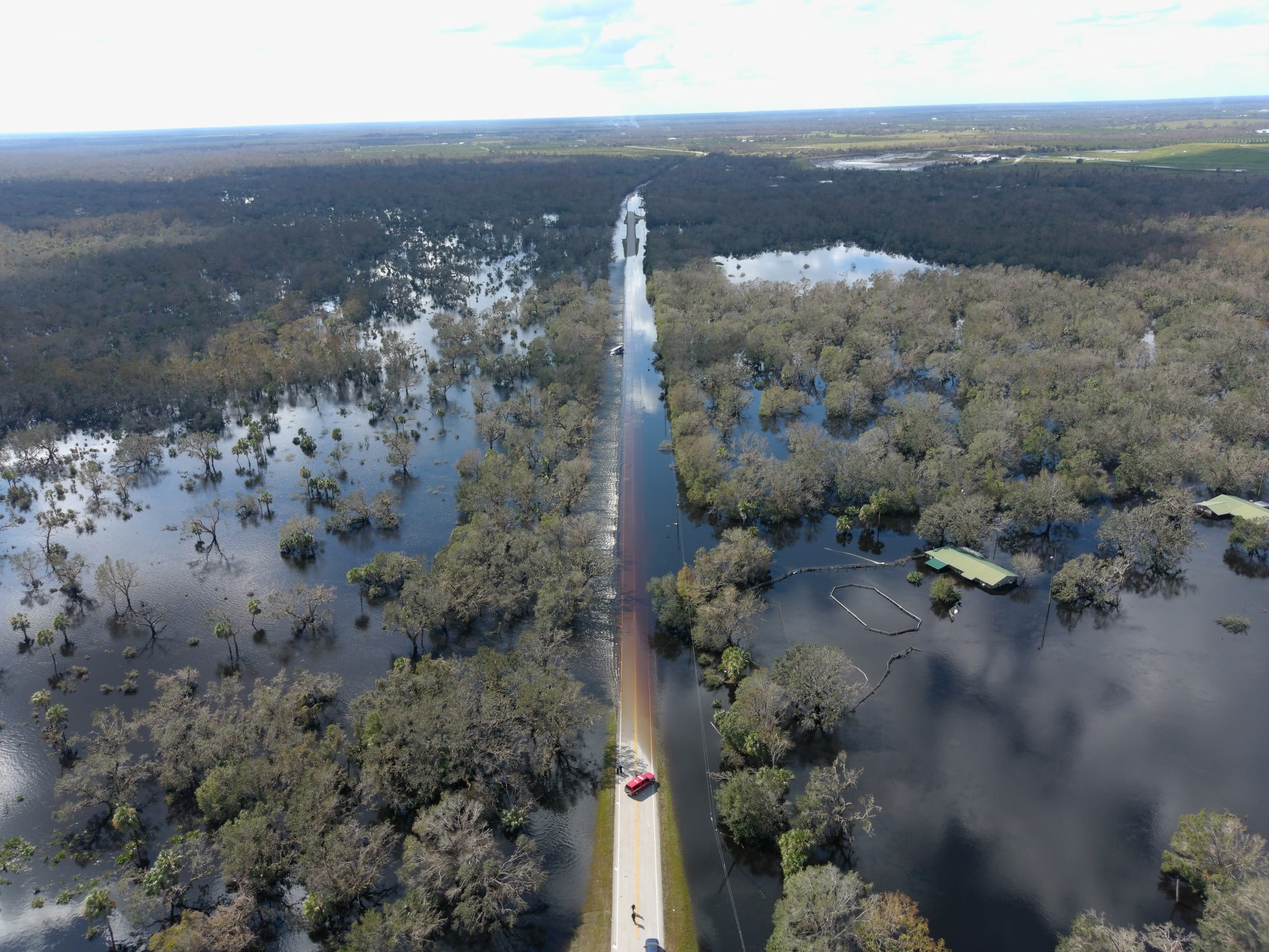
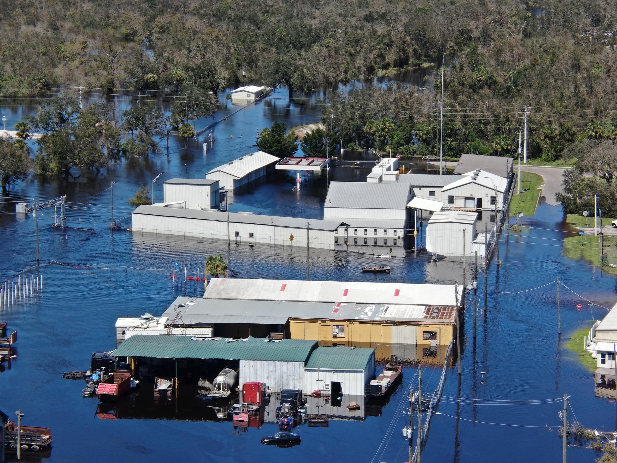
During its six-day deployment the team worked throughout DeSoto County to provide aerial views of flooding after the storm surge raised the Peace River and other Charlotte Harbor tributaries making ground access impossible for disaster response vehicles from DeSoto County Sheriff’s Office (DCSO), DeSoto County Fire Rescue (DCFR), Florida Fish and Wildlife Conservation Commission (FWC), Florida Highway Patrol (FHP), Department of Environmental Protection (DEP), Florida Department of Transportation (FDOT), and local road and bridge engineers.
In a Facebook posting the HCFES said that FL-UAS 4 gathered video and still frame images and 2D mosaic maps of locations throughout the County to help emergency management teams decide where to deploy resources including Points of Distribution where people stranded by the flood waters could obtain food and water. In addition, the drone team responded to reports of people stranded on their roofs to escape flooding.
FL-UAS 4 also obtained video and still images of bridges that helped FDOT and local Department of Public Works (DPW) engineers assess their structural integrity and to determine whether those bridges were safe for use after flood waters receded.
Finally in Arcadia, FL-UAS 4 helped the Florida Hazmat Coordination team respond to reports of leaks from tanker cars on the railroad along the Peace River. As a result, within two hours after receiving the request, the pictures and video of the rail cars were sent back to Orlando for review by the Florida Department of Environmental Protection (DEP).
The ability for the drone team to provide near real time pictures, video and maps proved invaluable to the local emergency management team, the FDEM said.