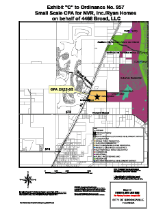
The Brooksville City Council unanimously approved a request from Ryan Homes to change the City’s comprehensive future land use map to allow for a new residential development. The Council voted in favor of the change during its regular meeting on March 6.
Situated on the east side of U.S. Highway 41 (Broad Street), and approximately 1,695 feet north of Powell Road the 49.3 acre parcel was annexed to the City in April, 2006. Currently, it has a Hernando County Residential Future Land Use designation, a Hernando County Agricultural zoning designation and is undeveloped.
The change would designate the parcel as City of Brooksville single Family/Multifamily Residential to allow for the consideration of up to 493 units, 10 dwelling units per acre and a non-residential Floor Area Ratio (FAR) of up to 1,073,754 square feet.
In his presentation Cliff Manuel, Jr., president and principal engineer of Coastal Engineering Associates, Inc. said that developers worked with city planners to bring the project forward.
“We went through all the staff’s comments related to water, sewer, roads, capacity, concurrency on 41, and sewer and water capacity to provide sewer and water to the project,” Manuel said. “And we believe it (the project) would be a good addition to the city of Brooksville.”
Brooksville City Planer Steve Gouldman recommended that the Council approve the map change request.
Before the vote took place, Brooksville resident Earl Hanaway told the panel that he was concerned about flooding in the area designated for future development.“I know that area floods quite often, and to develop a residential area there, I don’t see how it could be done,” Hanaway told the Council. “I don’t know of any insurance company that would insure a home in a flood zone like that.”
In response, Manuel said that all properties that are developed in Brooksville are subject to regulations using a Southwest Florida Water Management District (SWFWMD) model that is coordinated with the Federal Emergency Management Agency (FEMA) to map all the flood areas where development would not be appropriate. “You don’t put a home in the flood plain,” Manuel said.
Also, he said buyers of developed lots receive a so-called Letter of Map Amendment (LOMAR) issued by FEMA showing that they are out of the flood plain with their developed lots.
Ultimately the panel voted 5-0 to approve the change to City’s comprehensive future land use map. The vote approved the second and final reading of the ordinance.

