Hernando County Emergency Management Director David DeCarlo reported that the afternoon update on Hurricane Idalia for Hernando County hasn’t changed much from the 7 a.m. update. They still anticipate a six to nine-foot storm surge, which DeCarlo described as a “catastrophic storm surge” and “life-threatening.” The storm is approximately 280 miles wide from north to south. The eastern part of the eye wall is much larger than the western side. He said that as the storm moves through the state of Florida, the outer rain bands will continue to push through Tampa Bay, Pasco, Hernando, Citrus, and Levy counties with an elevated risk of tornadoes into Wednesday.
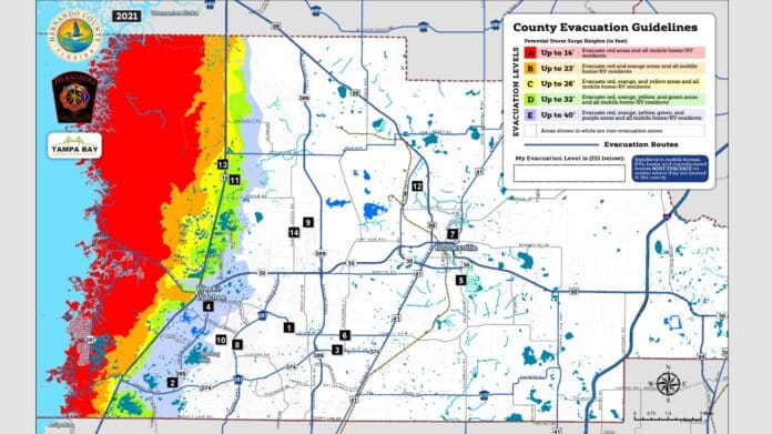
Commissioner Hawkins spoke about the mandatory evacuation of zones A, B, and C on the western edge of the county. He said that currently, residents can still travel to and from those areas but will need to show identification. Hawkins stated that this will change as soon as weather conditions begin to deteriorate. He urged residents in zones A, B, and C to evacuate as soon as possible if they have not already done so.
The Hernando County Board Chairman, John Allocco, also urged residents west of US 19 to evacuate, saying it’s not worth your lives or the lives of first responders.
Four shelters are currently open. As of 12:30 p.m., there are 59 people and 36 pets who have sought shelter in one of the four shelters. Emergency response will stop once tropical storm-force winds start coming into Hernando County. DeCarlo stated that this would be sometime in the late evening, according to the National Weather Service.
County residents can arrange for transportation out of the evacuation zones. Call 352-754-4083.
DeCarlo is expecting 30-40 mph winds and gusts up to 80 mph sustained throughout the night until possibly tomorrow afternoon. He says it is a long-duration event.
According to the current track, the eye of the storm will pass about 80 miles off the coast of Hernando County. DeCarlo predicts a more severe event than what was experienced in 2016 with Hurricane Hermine, possibly three to four feet higher storm surge.
“If your house flooded in 2016 in Hernando Beach, Pine Island, Aripeka area, it’s a good possibility it will flood again. If you did not flood, there’s a good possibility you will flood now because it is about three feet above what we experienced in 2016.”
For information on area shelters:
https://www.hernandosun.com/2023/08/28/hernando-county-calls-for-voluntary-evacuations-in-vulnerable-areas-and-lists-shelters/

