On Aug. 29, county officials anticipated a six to nine-foot storm surge in coastal areas of Hernando County from Hurricane Idalia. Hernando County Emergency Management Director David DeCarlo described this as a “catastrophic storm surge” and “life-threatening.” As it churned in the Gulf of Mexico on Tuesday, the storm was approximately 280 miles wide from north to south. The eastern part of the eye wall was much larger than the western side.
The coastal zones of Hernando County were under mandatory evacuation. As of 12:30 p.m. on Tuesday, there were 59 people and 36 pets who had sought shelter in one of the four shelters. Area public schools closed on Monday in order to prepare select schools as shelters. DeCarlo expected 30-40 mph winds and gusts up to 80 mph sustained throughout the night until possibly Wednesday afternoon. He said it would be a long-duration event.
According to the track on Tuesday, the eye of the storm was expected to pass about 80 miles off the coast of Hernando County. DeCarlo predicted a more severe event than what was experienced in 2016 with Hurricane Hermine, possibly three to four feet higher storm surge. “If your house flooded in 2016 in Hernando Beach, Pine Island, Aripeka area, it’s a good possibility it will flood again. If you did not flood, there’s a good possibility you will flood now because it is about three feet above what we experienced in 2016.”
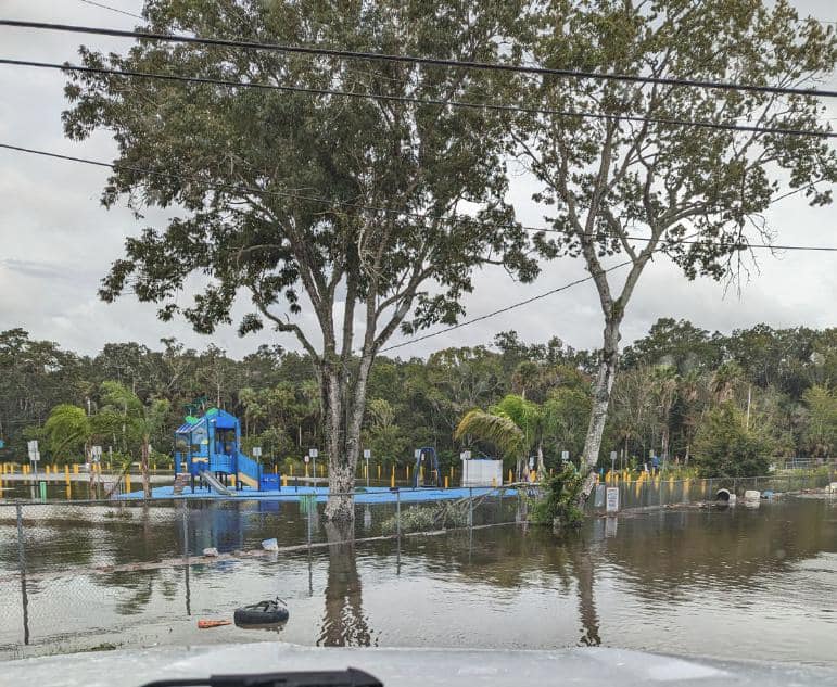
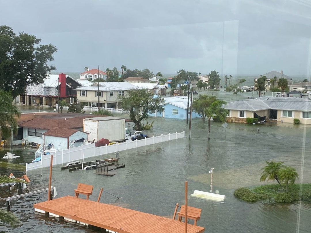
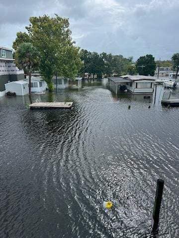
Early Wednesday morning, Hurricane Idalia made landfall as a category three hurricane in Keaton Beach, in the Big Bend area of Florida. Coastal Hernando County experienced flooding overnight and Wednesday morning, with officials expecting water levels to rise Wednesday afternoon with a “king high tide.”
According to the National Ocean Service, “King Tide is a non-scientific term people often use to describe exceptionally high tides. Tides are long-period waves that roll around the planet as the ocean is “pulled” back and forth by the gravitational pull of the moon and the sun as these bodies interact with the Earth in their monthly and yearly orbits. Higher than normal tides typically occur during a new or full moon and when the Moon is at its perigee, or during specific seasons around the country.”
During a Wednesday morning press conference, Hernando County Emergency Management Director David DeCarlo said that although tropical storm force winds will continue to subside as the day progresses, coastal areas are still vulnerable to storm surge. “Our high tide is forecast at 1:20 this afternoon. We are in a king high tide cycle – so that high tide will last a few hours more than normal. That is our biggest concern.”
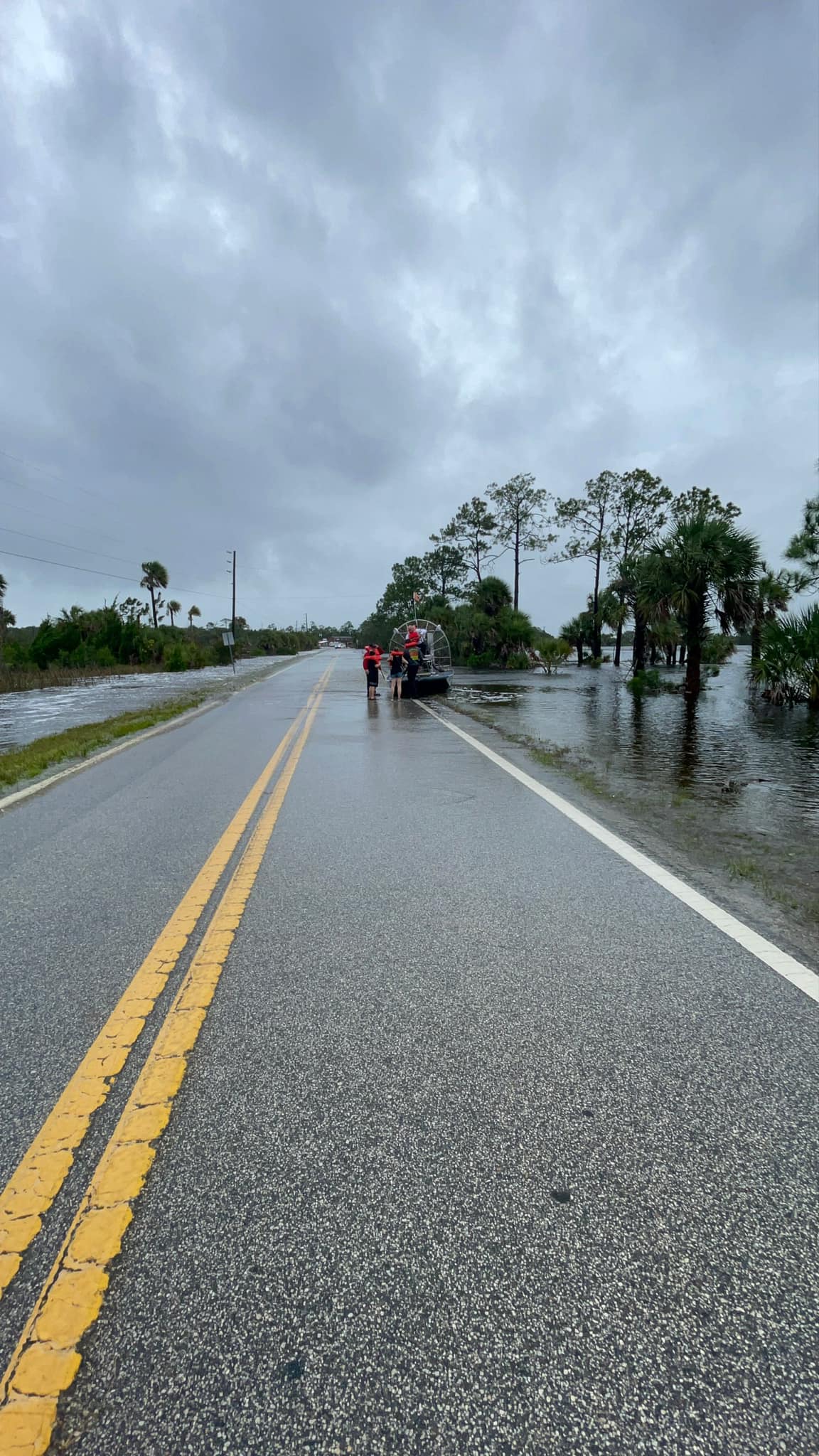
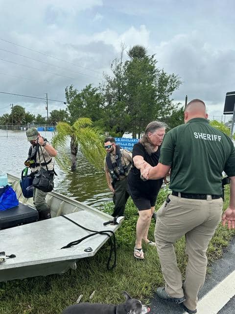
“The storm waters are coming in as we speak,” DeCarlo said. Residential areas of Hernando Beach are under restricted access at both north and south entrances. Water assets and agencies, including the Hernando County Sheriff’s Office, Hernando County Fire Rescue, Search and Rescue teams, and the National Guard, were on standby to do water rescue, and power was shut down in flooded coastal areas for emergency protective measures.
Withlacoochee River Electric shut down power at Hernando Beach, Bayport, Weeki Wachee, Pine Island, and Aripeka.
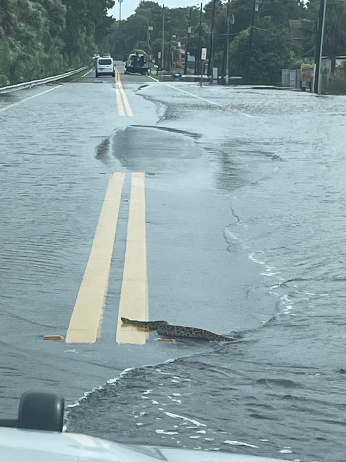
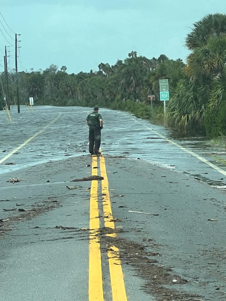
Hernando County Fire Rescue Chief Hasenmeier echoed that Hernando County was still in a serious situation on Wednesday morning as the storm surge was on the rise and flooding roadways. At one point on Wednesday morning, the water was around four feet above Pine Island Drive, and rescuers were called into action to save two people attempting to evacuate from Pine Island. They got stuck on one of the higher bridge areas, and the rescue was a coordinated effort between fire services, marine units, special ops, and the sheriff’s office.
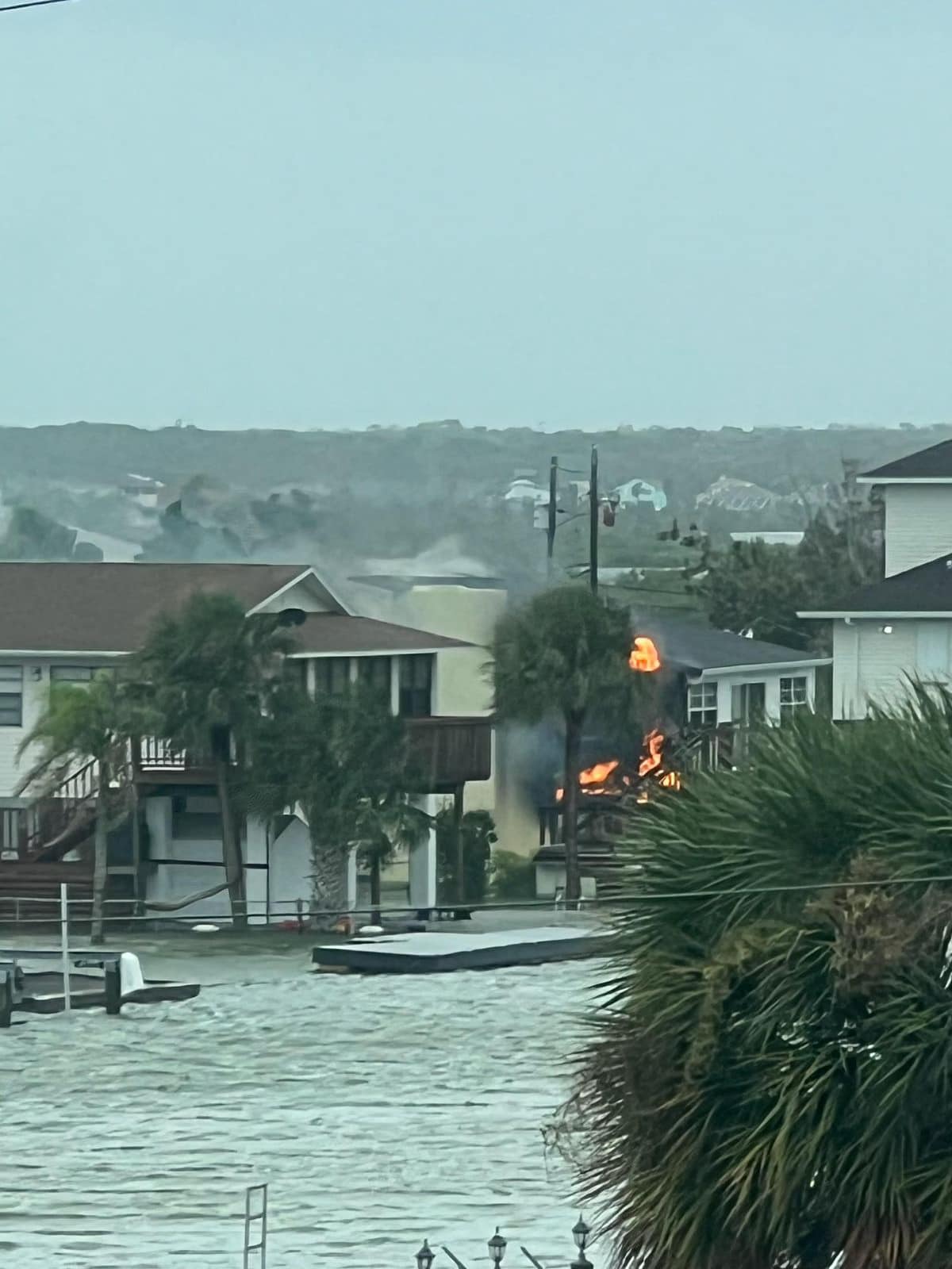
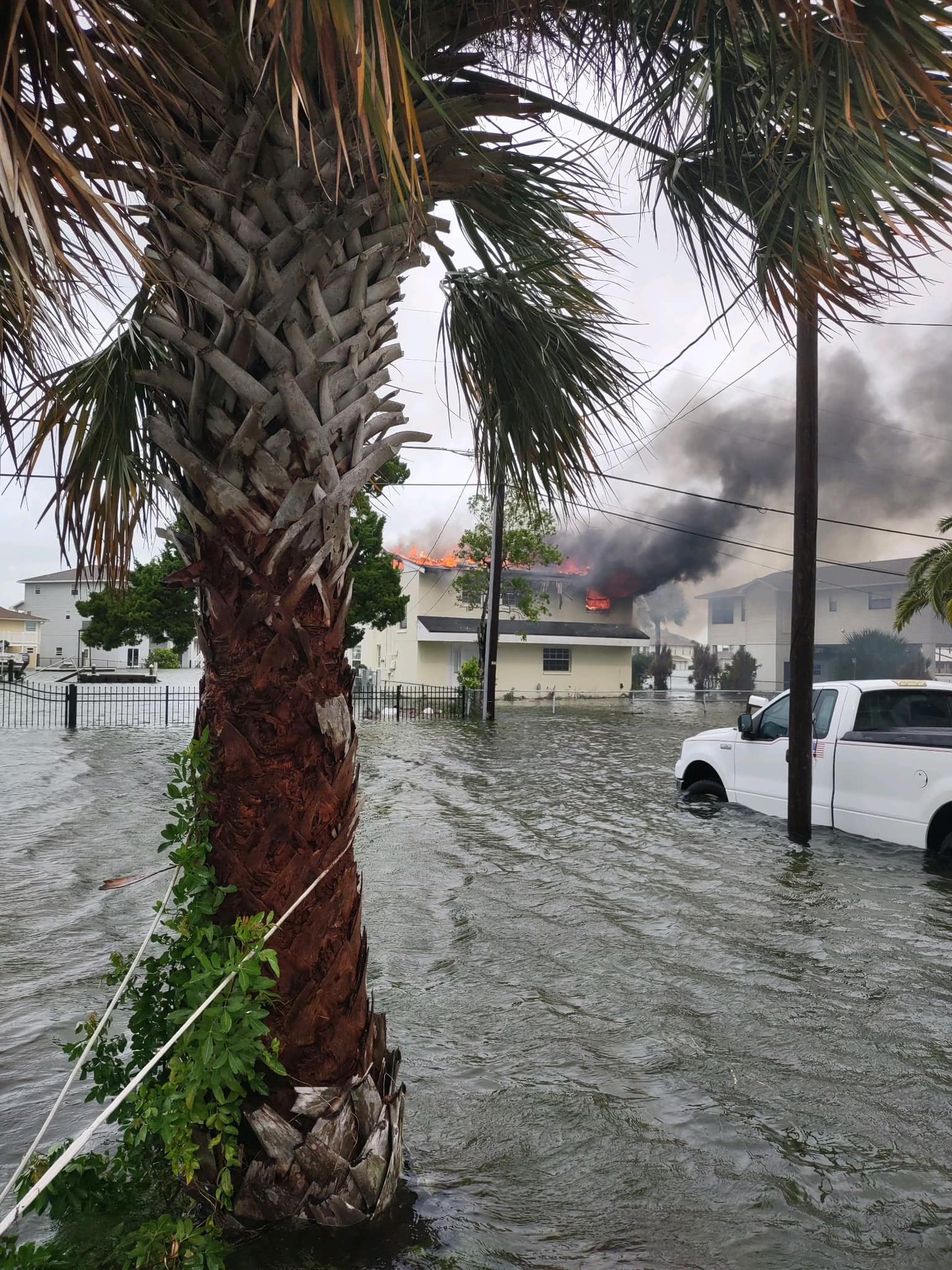
A home on Hernando Beach in the 3200 block of Gulf Winds Circle caught fire around 11:30 a.m. on Wednesday. Due to the storm surge, HCFR could not access the home, which they believe was vacant. They expect that the home will be a total loss.
Chief Hasenmeier said that the National Guard was available with high-water vehicles in addition to Sheriff’s Office/Fire Rescue boats. They were also coordinating with military assets for air support if lift capabilities were needed.
Hasenmeier urged people not to go west of 19 because the surge is coming up for the next couple of hours. Commissioner Jerry Campbell gave his prayers to our neighbors to the north and stated that we are not out of the woods yet with the high tide coming.
On Wednesday morning, there were 350 people in shelters and approximately 60 animals. Rescue efforts continued throughout the day on Wednesday. Sheriff Al Nienhuis stated that a Marine Unit would be patrolling Hernando Beach area Wednesday evening to prevent looting.